


Steinauer Precinct, Pawnee County, Nebraska
About
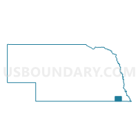
Outline

Summary
| Unique Area Identifier | 613685 |
| Name | Steinauer Precinct |
| County | Pawnee County |
| State | Nebraska |
| Area (square miles) | 108.30 |
| Land Area (square miles) | 107.87 |
| Water Area (square miles) | 0.43 |
| % of Land Area | 99.60 |
| % of Water Area | 0.40 |
| Latitude of the Internal Point | 40.22624010 |
| Longtitude of the Internal Point | -96.30194750 |
Maps


Graphs
Select a template below for downloading or customizing gragh for Steinauer Precinct, Pawnee County, Nebraska


Neighbors
Neighoring Voting District (by Name) Neighboring Voting District on the Map
- Burchard Precinct, Pawnee County, NE
- Filley/Logan Precinct, Gage County, NE
- Island Grove Precinct, Gage County, NE
- Nemaha 1 Precinct, Johnson County, NE
- Pawnee Precinct 2, Pawnee County, NE
- Rockford/Sherman Precinct, Gage County, NE
- Table Rock Precinct, Pawnee County, NE
- Todd Creek Precinct, Johnson County, NE
- Western Precinct, Johnson County, NE
Top 10 Neighboring County Subdivision (by Population) Neighboring County Subdivision on the Map
- Precinct 2, Pawnee No. 2, Pawnee County, NE (802)
- Precinct 3, Table Rock, Pawnee County, NE (409)
- Precinct 5, Burchard, Pawnee County, NE (394)
- Precinct 4, Steinauer, Pawnee County, NE (334)
- Filley township, Gage County, NE (322)
- Todd Creek precinct, Johnson County, NE (308)
- Sherman township, Gage County, NE (181)
- Precinct 7, Turkey Creek, Pawnee County, NE (168)
- Western precinct, Johnson County, NE (136)
- Island Grove township, Gage County, NE (105)
Top 10 Neighboring Place (by Population) Neighboring Place on the Map
Top 10 Neighboring Unified School District (by Population) Neighboring Unified School District on the Map
- Johnson County Central Public Schools, NE (4,584)
- Humboldt Table Rock Steinauer Public Schools, NE (3,300)
- Freeman Public Schools, NE (1,913)
- Pawnee City Public Schools, NE (1,566)
- Johnson-Brock Public Schools, NE (1,347)
- Lewiston Consolidated Schools, NE (1,021)
Top 10 Neighboring State Legislative District Upper Chamber (by Population) Neighboring State Legislative District Upper Chamber on the Map
Top 10 Neighboring 111th Congressional District (by Population) Neighboring 111th Congressional District on the Map
Top 10 Neighboring Census Tract (by Population) Neighboring Census Tract on the Map
- Census Tract 9676, Johnson County, NE (3,206)
- Census Tract 9678, Pawnee County, NE (2,773)
- Census Tract 9652, Gage County, NE (2,771)
- Census Tract 9646, Gage County, NE (2,725)
- Census Tract 9675, Johnson County, NE (2,011)
Top 10 Neighboring 5-Digit ZIP Code Tabulation Area (by Population) Neighboring 5-Digit ZIP Code Tabulation Area on the Map
- 68450, NE (3,182)
- 68420, NE (1,285)
- 68447, NE (464)
- 68323, NE (315)
- 68441, NE (302)
- 68348, NE (256)
- 68381, NE (249)
- 68332, NE (146)
- 68458, NE (135)
- 68380, NE (81)